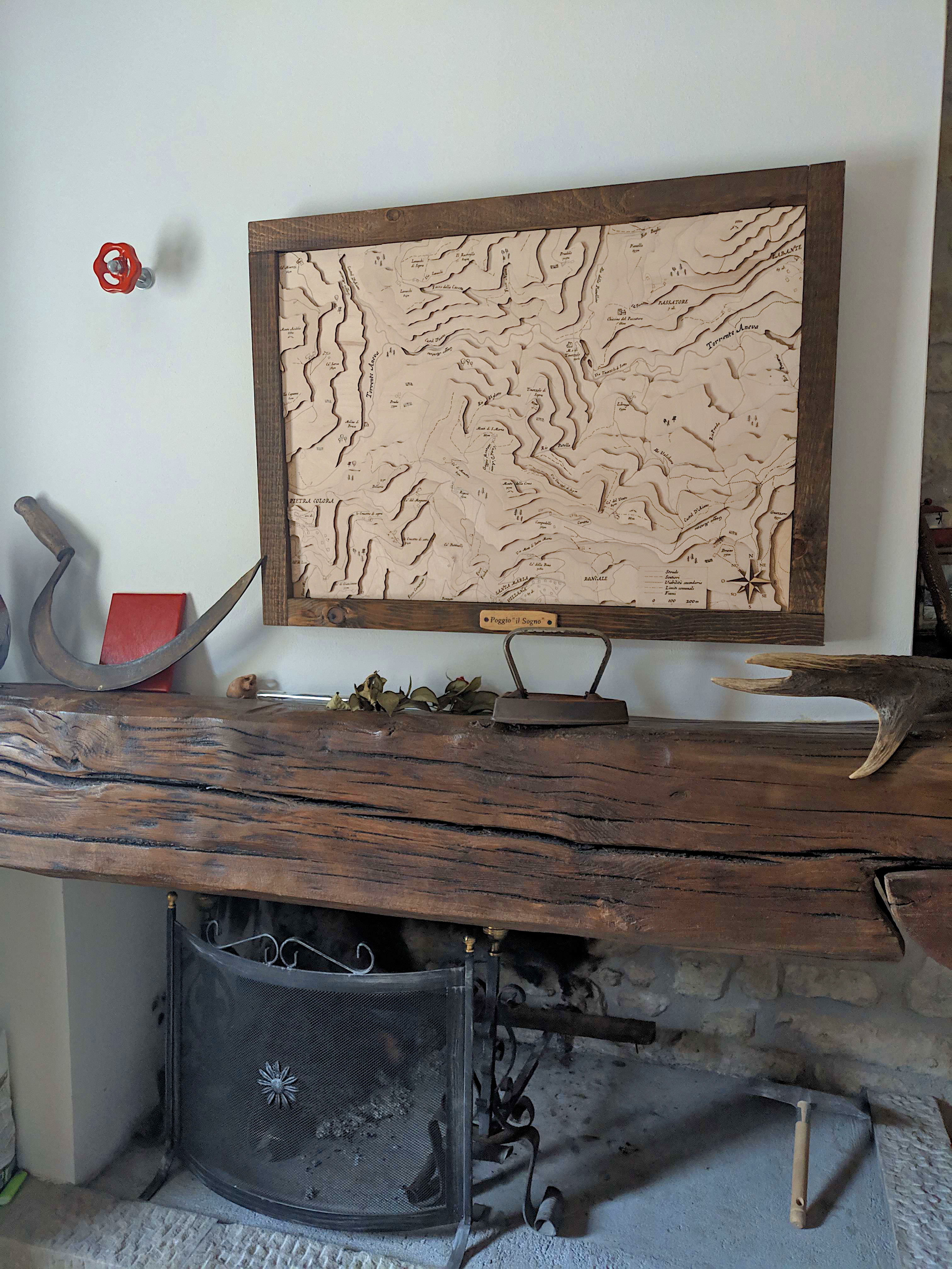
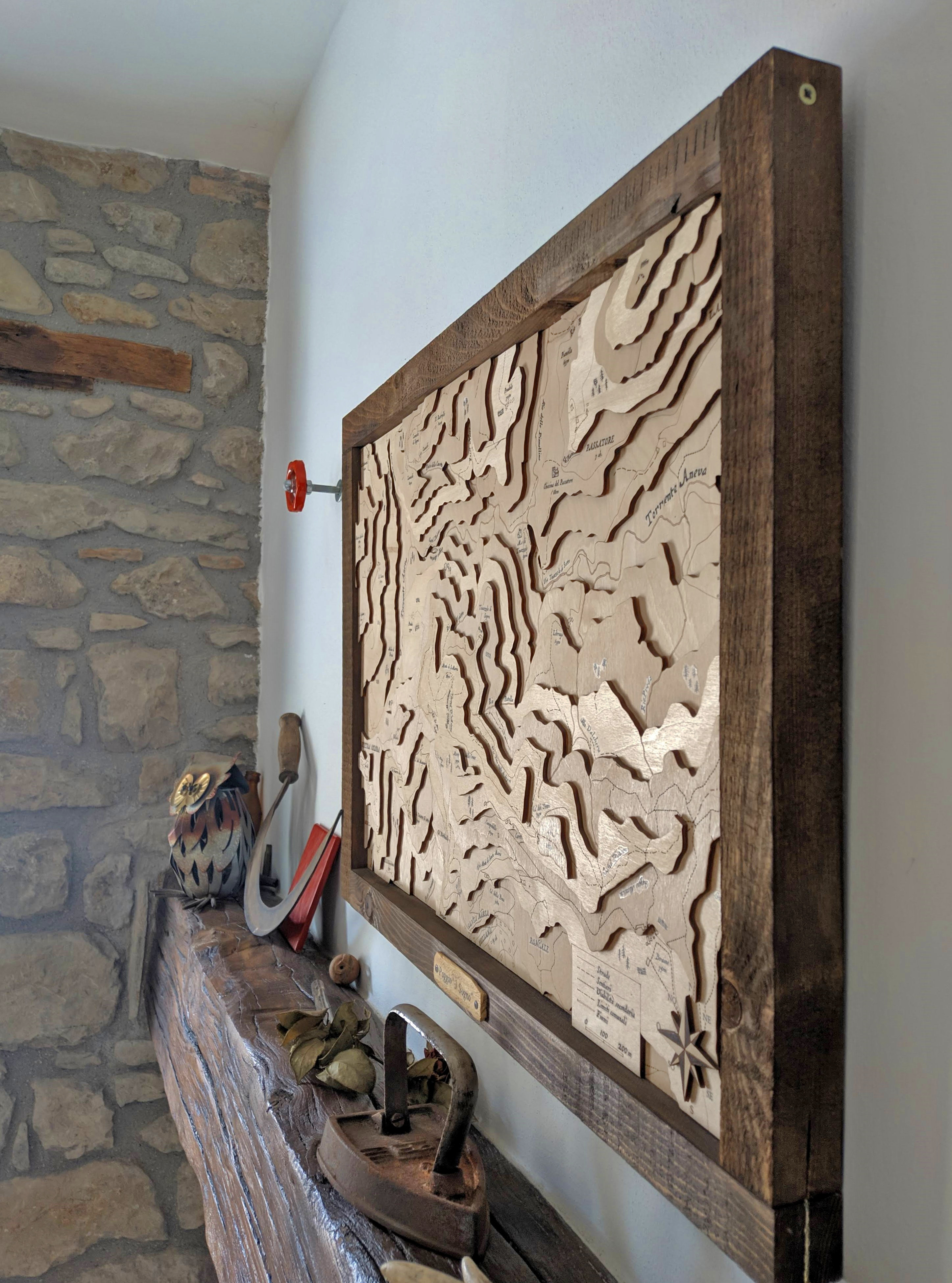
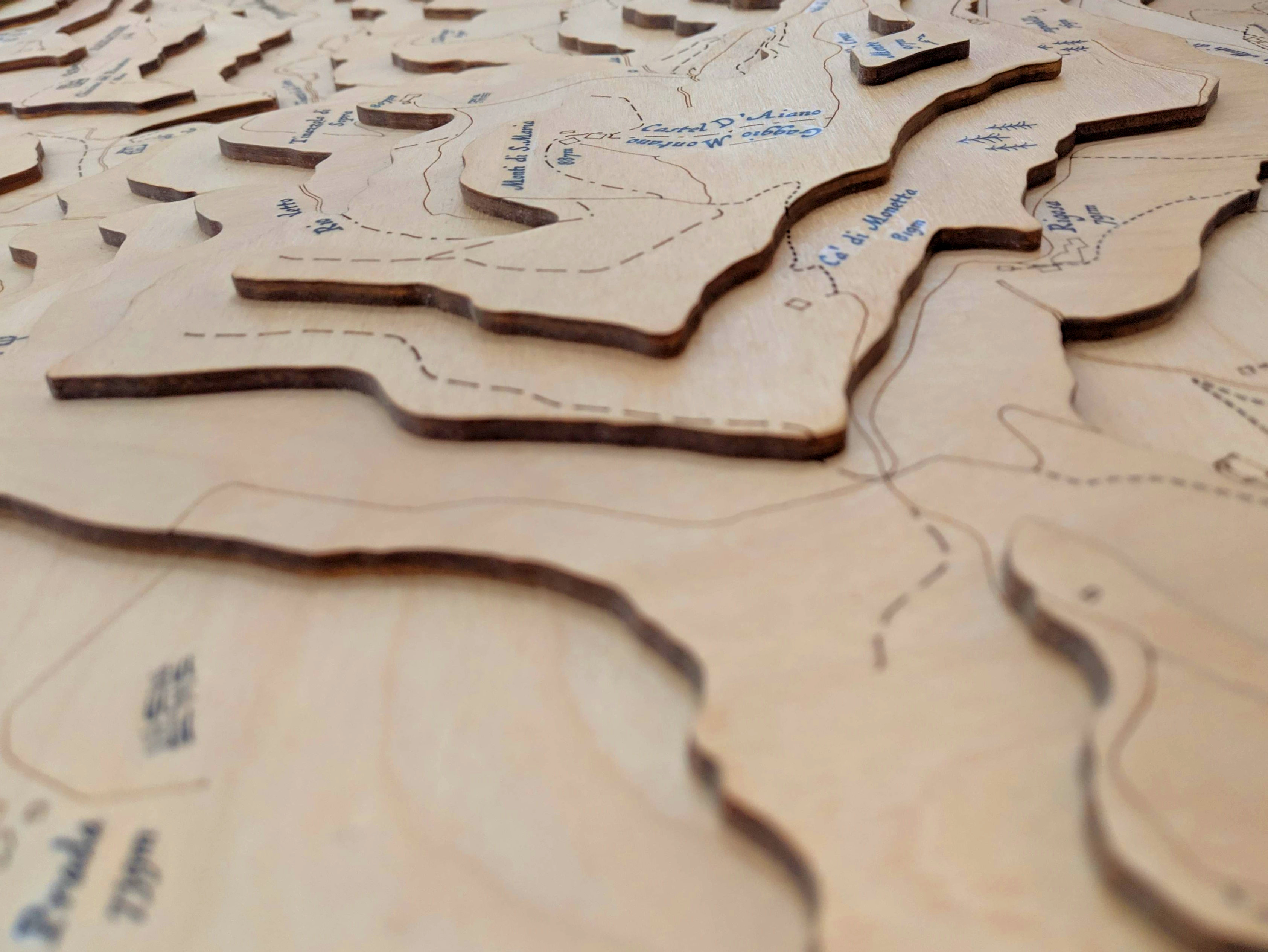
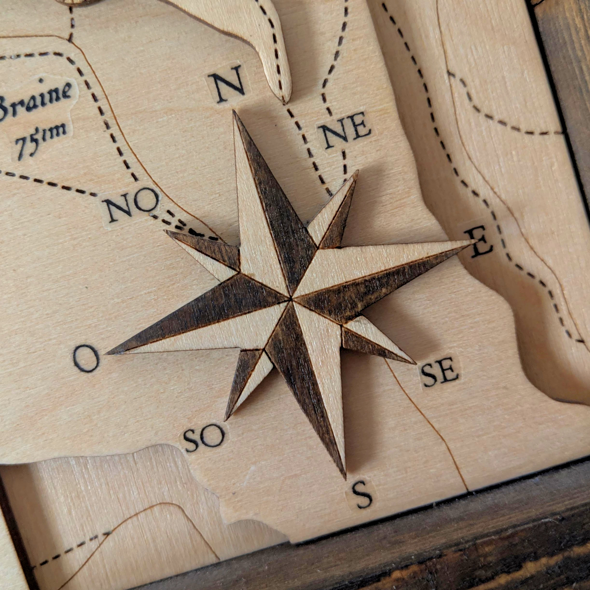
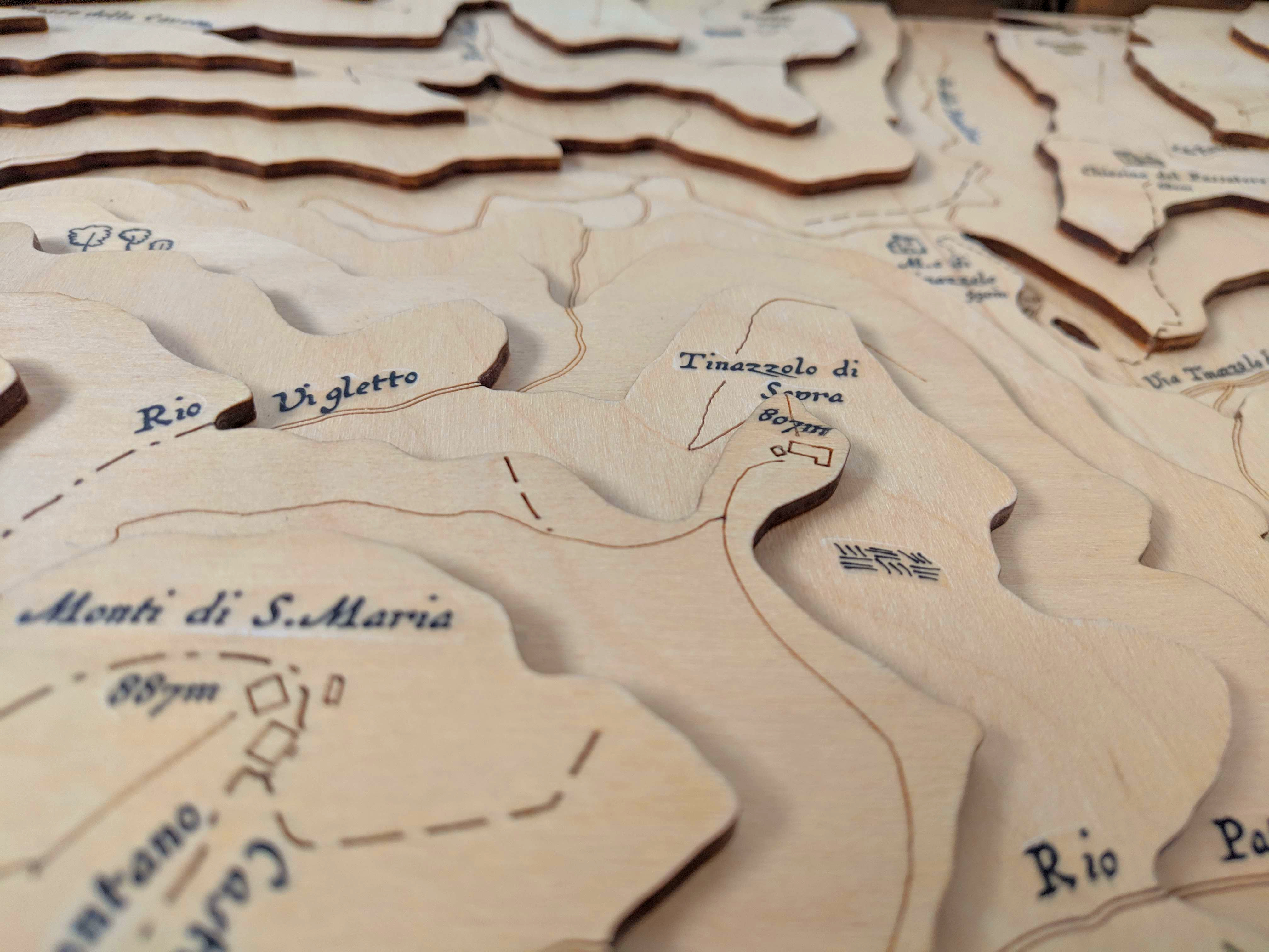
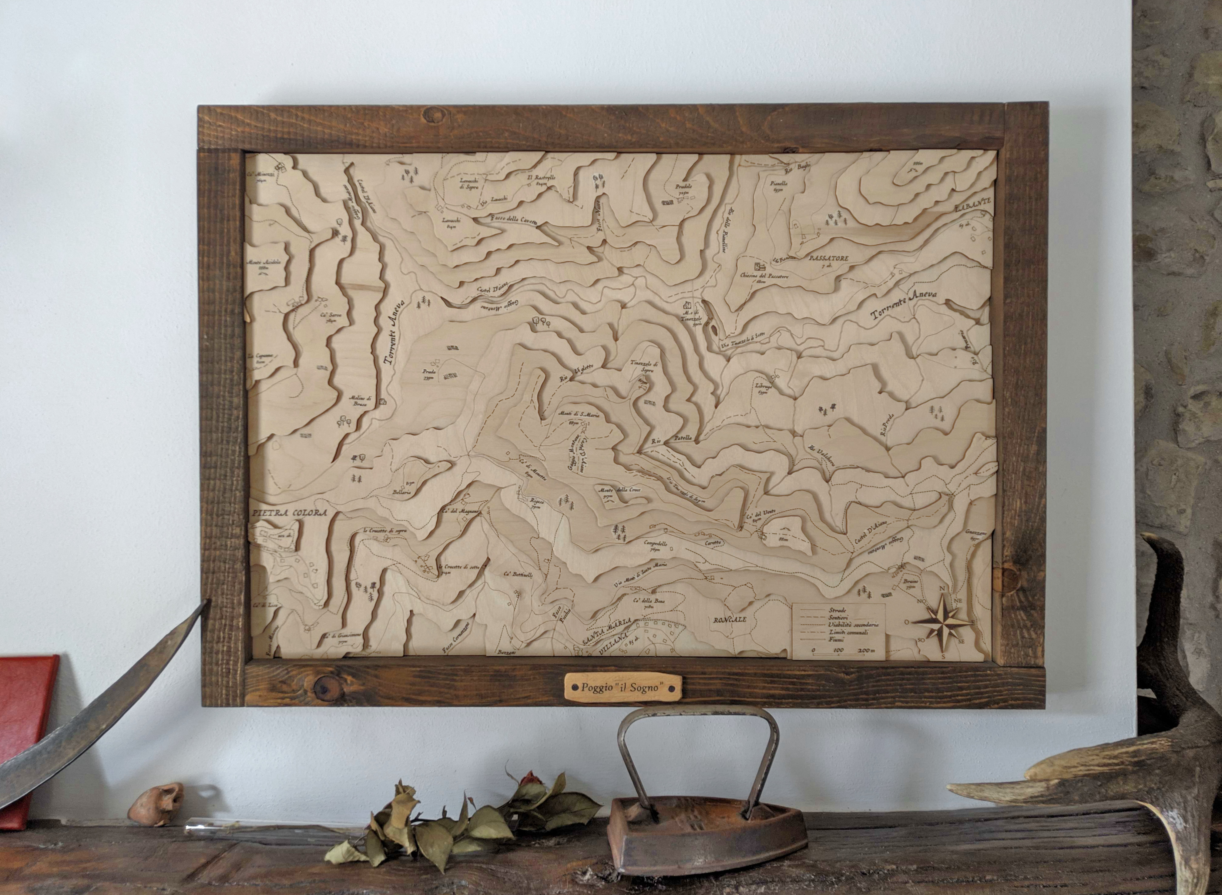
Laser cut map
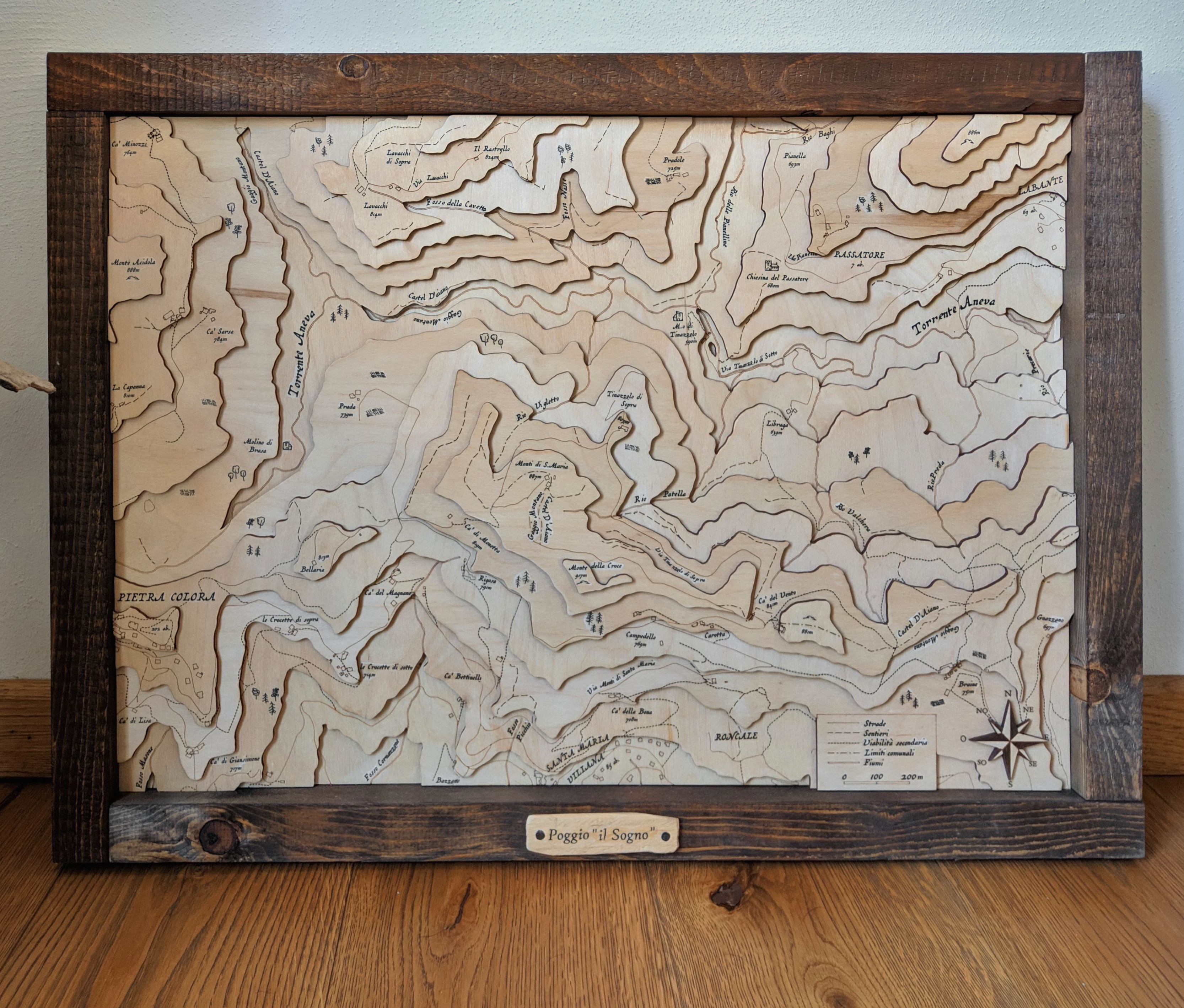
This is a to-scale map of the area around my uncle’s house. Creating it was quite a challenge, as I had no prior experience. I began by researching how to obtain topographical data for a specific location. While there are some global low-resolution maps available, I needed a much higher resolution for the small area I wanted to depict. I discovered that such data is often available for free from institutional websites, such as Emilia Romagna ARPAE in this case. I then used QGIS to create the 3D surface projection from the map contour lines. Here’s the result:
To achieve the desired level of detail, I needed to generate my own contour lines based on the elevation differences in the selected area. Using QGIS, I sliced the map to create these custom contour lines and then exported the vector data. With the vector data in hand, I turned to Affinity Designer to distinguish between the cutting and engraving lines. Once the design was ready, I sent the files to a professional laser cutting service. The laser-cut layers were then carefully glued together and mounted in a rustic wooden frame, adding a touch of character to the piece. To complete the map, I used inkjet heat transfer paper to print the names of roads and villages, which make it look like a map of Middle-Earth.